
GM IS USING CAMERAS ON CUSTOMER CARS TO BUILD SELF-DRIVING CAR MAPS
(autonomous vehicles – part 3)
#AUTONOMOUS VEHICLES, #GENERAL MOTORS
Picture:URL:http://www.wired.com/wp-content/uploads/2016/01/GM_Mobileye_R5_8.10-094.jpg or URL:http://www.wired.com/2016/01/gms-building-self-driving-car-maps-with-cameras-on-customer-cars/
Article: (from WIRED – http://www.wired.com/category/transportation/)
- “GM’s Using Cameras on Customer Cars to Build Self-Driving Car Maps
Author: Alex Davies; Date of Publication: January 5, 2016
URL:http://www.wired.com/2016/01/gms-building-self-driving-car-maps-with-cameras-on-customer-cars/
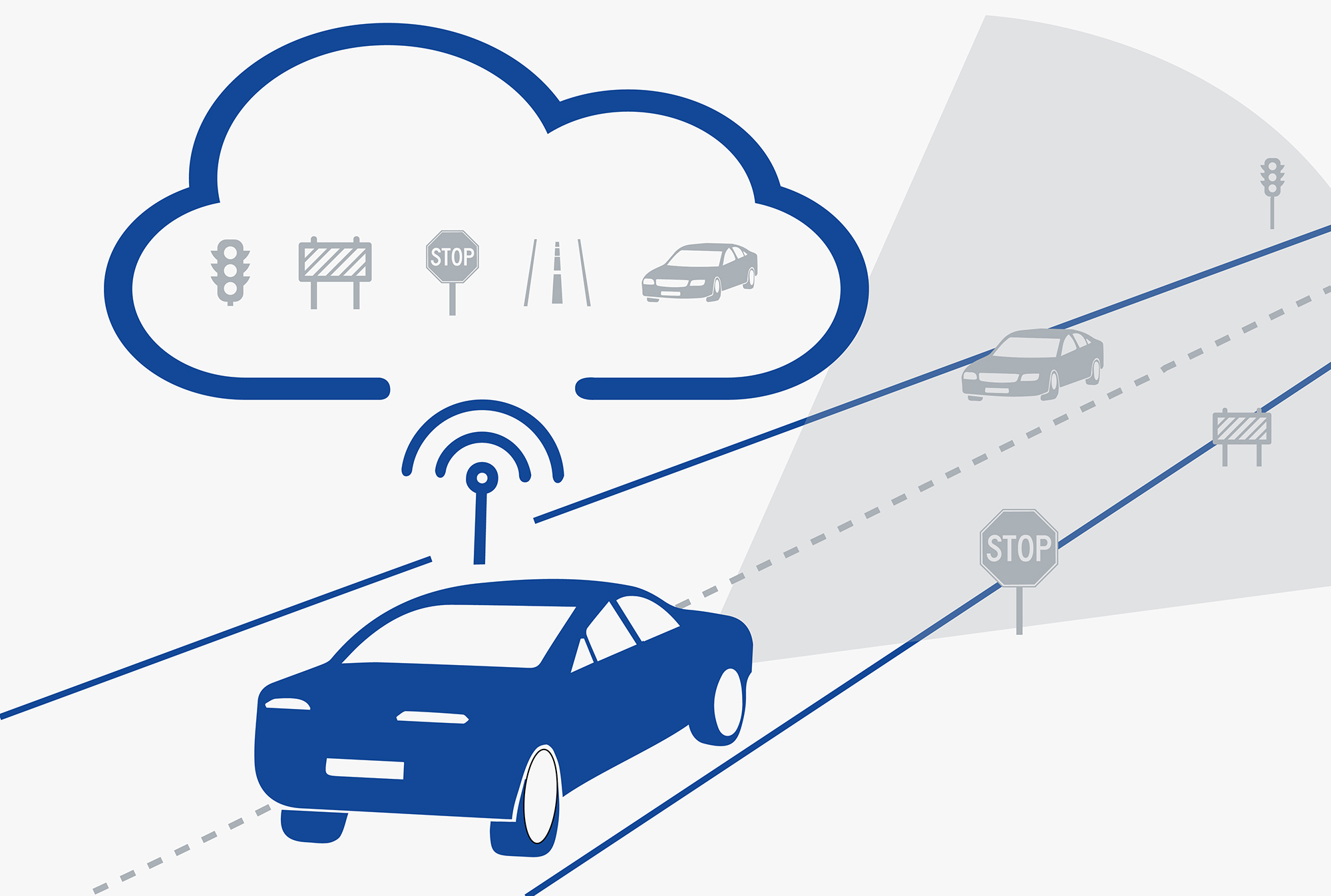
General Motors is planning to use cameras on customer cars in order to create as well as develop the maps that will help self-driving cars navigate. What is crucial to stress is the information that the American automobile manufacturer is analyzing – scrutinizing – new technology from Mobileye, an Israeli provider of visual processing chips and software. It has to be emphasized that the technology invented and supplied by the Mobileye Company is able to identify vehicles, pedestrians, and other obstacles, as well as road markings, signs, and traffic lights. Furthermore, it is necessary to stress that the Mobileye technology powers favorite features like lane departure warnings, and is introduced into hundreds of thousands of GM cars. What is also important to emphasize is the fact that GM’s concept bases on pulling that camera data – exploiting its OnStar system – from client vehicles to design exceptionally accurate, constantly updated road maps. Moreover, it is crucial to stress that those maps would allow a driverless car to know its position within about 10 centimeters. It has to be emphasized that it is a great advantage over contemporary GPS systems, which estimate location counting the margins of error in meters – “Good enough for knowing what street you’re on, but not for navigating a robo-car through traffic,” Davies stresses. It is possible to conclude that mapping processes compose an increasingly critical, valuable part of the pursuit towards the automotive autonomy. The more data regarding specific area a vehicle receives, the more it can concentrate its sensors and computing power on temporary obstacles like cars, pedestrians, and cyclists. “Creating and updating maps using on-board camera technology supplies the missing link between on-board sensing and the requirement for full redundancy to enable safe autonomous driving,” says Amnon Shashua, Mobileye’s co-founder and CTO. Furthermore, Alex Davies concludes: “That’s why the consortium of BMW, Audi, and Mercedes recently bought Nokia’s mapping arm, HERE, for $3.1 billion. It’s why TomTom is still relevant. It’s why Google has a fleet of cars loaded with sensors scoping out all the roads its autonomous cars will later traverse.” It has to be emphasized that as the maps General Motors aims to create will depend on visual data, they are unlikely to be as comprehensive as well as precise as those that HERE, TomTom, and Google are developing – as those which are based principally on LIDAR data. Nevertheless, it is possible to conclude that GM possesses an instantaneous advantage by using technology that goes into its cars anyway – scale. “GM is committed to bringing semi-autonomous and fully autonomous vehicles to our customers, and this technology will be a critical enabler to getting us there,” says Mark Reuss, GM’s head of product. What is crucial to stress here is the fact that, currently, GM is testing the technology on five cars; the second phase would extend that up to 30. If that testing goes well, a company representative stresses: “this could move quickly,” concluding that the company could deploy the technology into its new vehicles later this year.
I would like to stress that even though the constantly updated maps General Motors aims to develop will depend on visual data and they are unlikely to be as precise as those which are based principally on LIDAR data, GM, while pulling the camera data, will base on its OnStar service (a personal onboard assistant) therefore it will possess an instantaneous advantage by exploiting technology that can be activated within its cars anyway. All things considered, it is necessary to emphasize that the mapping processes compose an increasingly critical, valuable part of the pursuit towards automotive autonomy.
MZ