Tag Archives: Ocean

Dangerous, unpredictable ocean: Is AI the key to unlock and discover the mysterious ocean’s depths?

Reading Time: 4 minutes
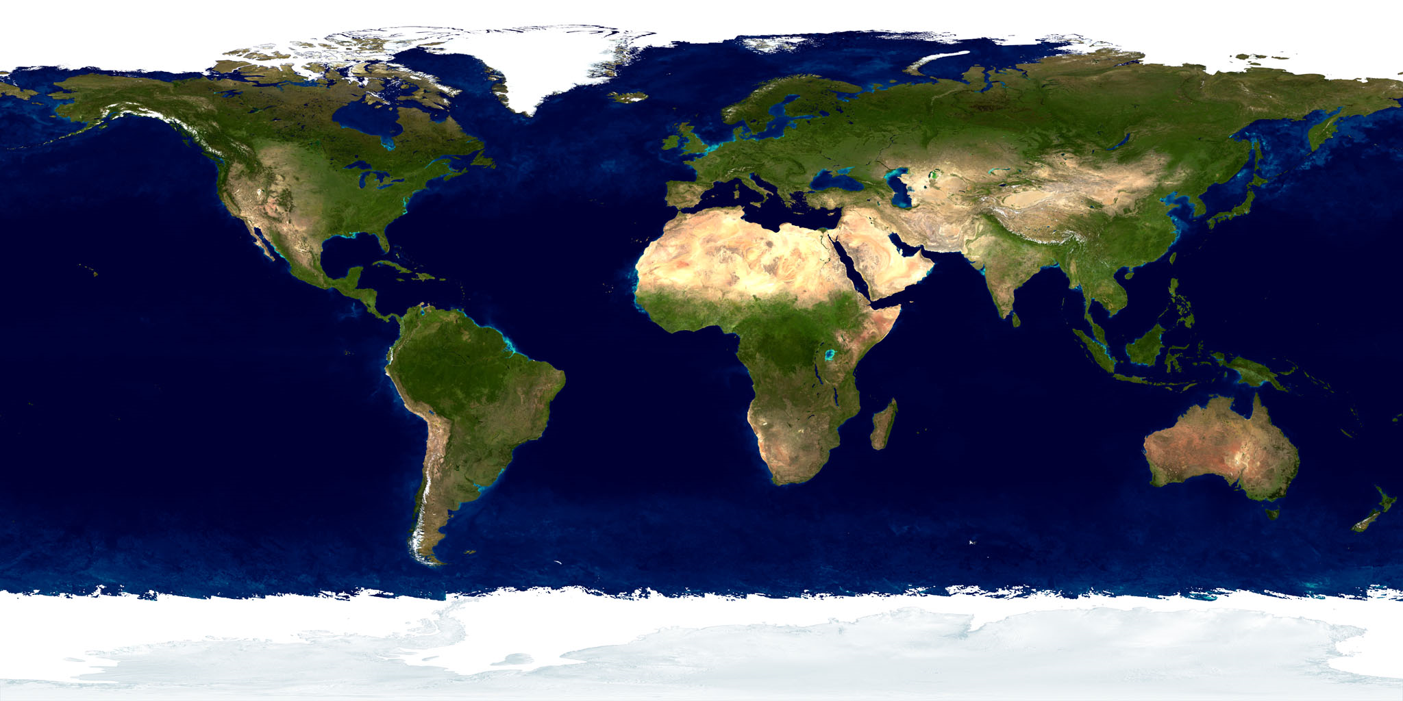
Our planet, Earth, is covered 70% by a large area of salt water which we call ocean. The total surface of all oceans in our planet are equal around 361 million kilometers per square.
Based on classification created by International Hydrographic Organization, we distinguish 5 oceans:
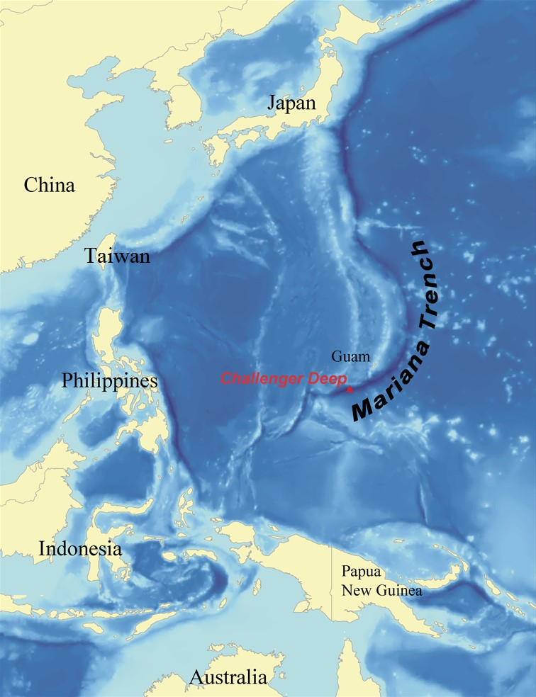
1.    The Pacific Ocean – the biggest ocean which occupies around 30% of the whole Earth.  Also, in the western part of the Pacific is located the Marian Trench that for now is known as the deepest place on our planet. The maximum measured depth is 10984 meters under sea level.
2.    The Atlantic Ocean – the second ocean when it comes to surface in the world. This ocean covers 20% of our planet with the biggest trench equal 9219 meters under sea level.
3.    The Indian Ocean – the third-largest ocean that covers 19,8% of the water on Earth’s surface. The deepest trench of this ocean is the Sunda Trench with a maximum depth of 7290 meters under sea level.
4.    The South Ocean – the fourth-largest ocean placed in the south part of our planet. Its deepest part is South Sandwich Trench with the deepest point at level of 8266 under sea.
5.    The Arctic Ocean – the smallest and shallowest ocean on Earth. It is situated around the Arctic. The deepest point of this ocean is the bottom of the region Amundsen around 4650 meters under the sea.
Oceans are badly big that people have discovered only a little part of them. Based on data less than 20% of the world’s ocean floor has been mapped in detail. Of course, humans are still working to create more information about the ocean floor but due to the hard conditions which are there it is a very slow process. However here with help comes AI that is bringing bright future to the exploration of the oceans because it will increase frequency of ocean expeditions and improve their efficiency. So, it is finally time for us to get more information about our planet?

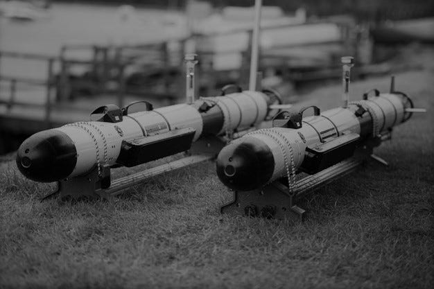
1.    Autonomous Seacraft.

First, AI can be used to automate submersibles that could work on their own. This action will give the opportunity to explore and map the seafloor for twenty-four hours per day. Without any doubt the area of exploration will grow immediately. Also, AI-powered submarines would decrease the risks of human lives from ocean expedition.

On the other hand, building such a vehicle is a risky project due to the condition that is in the deepest part of our oceans. Even the hardest elements which we know for today will not survive undamaged for long time on 8000 meters level under the sea level because of big pressure and corrosiveness of salt water. Unfortunately, today’s building material is going to be destroyed against ocean nature.

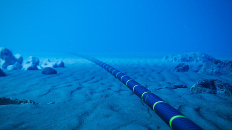
2.    Ocean Data Analysis.

Using AI algorithms in oceans exploration can efficiently process and analyze large volumes of precise oceanographic data, including data from satellites, buoys, and underwater sensors.  This capability allows for the rapid identification of patterns, anomalies, and trends in oceanographic variables such as temperature, salinity, and currents. Predicting the ocean’s condition will allow us to prepare properly for the ocean expedition.

However, relying too much on AI ocean analysis can be very misleading because data in the ocean is changing rapidly. Due to these algorithms can be inefficient and can generate wrong output.

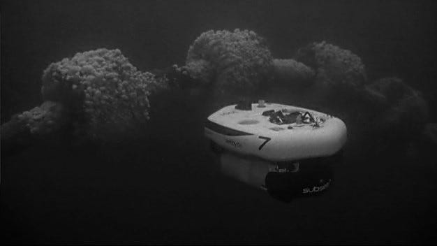
3.   Precision Mapping of Ocean Floor.

AI is revolutionizing the process of creating underwaters map thanks to advanced imaging technologies and machine learning algorithms. Sonars powered by this AI technology which are put under the water, are finding underwater resources, identifying potential hazards, and searching for helpful data that is really needed for ocean explorations. Moreover, such gear can measure the depth in unknown parts of oceans.

It is worth saying that very remote environments on large depth under the sea can cause errors in the process of mapping ocean data. Because of the lack of light, it is hard for AI to analyze data which is surrounding it.

4.   Image and Video Analysis of Ocean.

AI-powered image recognition and computer vision can aid in the analysis of underwater imagery and videos. This is particularly useful for identifying marine species, studying underwater ecosystems, and monitoring the health of coral reefs. It is worth to add here that thanks to usage of image and video analysis we will be able to discover and describe new ocean species which have not been discovered before.

Although there are a lot of similar species in the ocean which cannot be correctly identified by AI. Hard conditions in the ocean have influence on bad quality of image and videos taken there. It would create errors or lack in the collected data which will extend the time of working with such ocean data.

Conclusion: AI is the new future of ocean explorations.

To sum up, AI is going to revolutionize ocean exploration. More ocean data will be gathered by it and new categories of submarines will be created. It will allow us to get more information and statistics from our oceans. Moreover, we are going to find new marine species and there is high probability that by using AI we will find new resources in the ocean that will give us power.

Disadvantages of using AI will be too much reliance on AI, data errors and of course costs which are produced by very hard and unpredictable ocean environment.

My opinion about this topic.

My thought about AI technology used in ocean exploration is that we must use it because we are standing in front of huge discovery of unknown places and species in our world. Nevertheless, we should remember that AI is not going to measure for us all mysterious about our water. We as humans need to use it in the correct way to get access to new data about the ocean.

I am looking forward to your comments about this interesting topic that without any doubt will bring us important facts and new information about our oceans.

Sources:

  • https://pl.wikipedia.org/wiki/Wikipedia:Strona_g%C5%82%C3%B3wna

Articles:

  • https://www.aljazeera.com/features/2023/9/14/titan-implosion-is-ai-the-future-of-deep-sea-exploration
  • https://annualreport.mbari.org/2022/story/unlocking-the-power-of-ai-for-ocean-exploration

AI Engine:

  • https://deepai.org/chat
Tagged ,

Underwater Robotics

Reading Time: 3 minutes

Autonomous Underwater Vehicles (AUVs) and Remotely Operated Vehicles (ROVs) are two types of underwater robotic systems that play an increasingly significant role in ocean exploration, scientific research, and various industrial operations. Although both systems are designed to operate underwater, they differ in terms of how they are controlled and the tasks they are capable of performing. Collectively, both AUVs and ROVs are categorized as Unmanned Underwater Vehicles (UUVs).

Two autonomous underwater vehicles resting on land
Project Wilton Iver AUVs, courtesy of our partner, SeeByte


An AUV is an autonomous underwater vehicle that often (but not always) operates independently of direct human control. It is equipped with various sensors, instruments, and navigation systems that allow it to perform a range of tasks, including mapping the ocean floor, collecting environmental data, and conducting scientific surveys at sea. Ideally, AUVs are programmed to perform specific missions and have the ability to make decisions based on real-time data, making them a great candidate for conducting long-term, repetitive missions. However, due to the lack of remote off-grid power solutions, big-data transmissions, and edge-compute capabilities, the current generation of AUVs still have a limited operational reach and require interventions of human operators.

A remotely operated vehicle inspecting underwater structures
Subsea 7’s AIV performing a mid-water riser inspection using sonar, courtesy of our partner, SeeByte


Remotely Operated Vehicles (ROVs), on the other hand, are underwater robots that are often controlled by a human operator. Like their AUV counterparts, ROVs are also equipped with cameras, lights, and various sensors that allow them to perform tasks (such as inspections, maintenance, and repair on underwater structures and vessels). ROVs can also be equipped with sampling tools and other scientific instruments, making them useful for conducting research missions. ROVs play a very prominent role in deep-sea scientific missions for studying benthic ecosystems, such as during the EV Nautilus cruises. (More on this later in another post.)
The main advantage of ROVs is that they allow for direct human control, which can be especially useful in situations where real-time decision-making is required. This makes ROVs ideal for missions that require a high degree of precision and control, such as the inspection of underwater pipelines, the repair of underwater communication cables, or the removal of debris from shipwrecks. Additionally, ROVs can be equipped with manipulator arms and other tools, making them capable of performing tasks that are (currently) not possible with AUVs.

Despite the differences between AUVs and ROVs, both systems play an important role in a variety of industries. In the oil and gas industry, for example, both types of underwater robots are used for exploration and production, as well as for monitoring and maintenance of underwater pipelines and platforms. In scientific research, both AUVs and ROVs are used for oceanographic surveys, as well as for monitoring ocean ecosystems and the effects of climate change.

As the blue tech industry continues to advance, it is likely that UUVs will play an even greater role in ocean exploration, scientific research, and industrial operations in the years to come, making them a pivotal component of the rapidly growing blue economy.

As for me the article is a clear and concise explanation of the differences between AUVs and ROVs, two types of underwater robotic systems that are widely used in the blue economy. It provides a brief overview of the main features, advantages, and disadvantages of each system, as well as some examples of how they are used in various industries and applications. The article also uses relevant images and links to illustrate the concepts and provide more information for the interested readers.

However, the article could also be improved in some ways. For instance, it could provide more details on the current challenges and limitations of AUVs and ROVs, such as the technical, operational, and regulatory issues that affect their performance and deployment. It could also discuss some of the emerging trends and innovations in the field of underwater robotics, such as the development of hybrid systems that combine the features of both AUVs and ROVs, or the use of artificial intelligence and machine learning to enhance the autonomy and capabilities of UUVs. It could also address some of the ethical and social implications of using UUVs in the ocean, such as the potential impacts on the marine environment and biodiversity, or the legal and moral responsibilities of the operators and users of UUVs.

Overall, the article is a good introduction to the topic of underwater robotics, but it could also go deeper and more critical in its analysis and discussion.

Resources: Underwater Robotics. Autonomous Underwater Vehicles, AUVs, ROVs | Ocean Motion Tech Blog (medium.com)

Images:
https://miro.medium.com/v2/resize:fit:786/format:webp/1*97hjk-NauNJkmtIHqlBAUQ.jpeg
https://miro.medium.com/v2/resize:fit:786/format:webp/1*FnMPVGUqgsx4xqOndGssIA.jpeg

Tagged , ,

Subsea Internet Cables Could Detect Earthquakes

Reading Time: < 1 minute

The UK’s National Physical Laboratory (NPL) and their partners say that the cables could be used as deep sea scientific sensors, helping to sense earthquakes, tsunamis, or see how climate change alters the currents.

Fibre-optic cable

This has already been tested by scientists through the use of a cable connecting the UK and Canada. This is being tested because installing sensors to monitor the ocean floor can be very costly and very difficult, and for that reason only very few of such sensors exist. Using subsea internet cables would be more cost effective.

Theres an estimated 430 of these cables, spanning over 800,000 miles, providing good coverage from country to country. Vibration, pressure, and temperature changes can slightly affect the speed that the light is travelling through these cables, which could be detected. As scientists could detect waves through the link from the UK to Canada, the same same could be done for the other cables around the world, providing a great coverage of underwater sensors. Theres also a potential, untested yet, possibility to sense the temperature change in the ocean due to climate change.

Overall, the ability to sense earthquakes, tsunamis, and other factors at such close range would be very beneficial, as it provides the possibility to have more time to prepare for such events, and with preparation damage and more importantly casualties could be limited.

Sources:

https://www.bbc.com/news/technology-61506705

https://www.science.org/doi/10.1126/science.abo1939

Tagged , , ,

Scientists have discovered an ocean on Saturn’s moon

Reading Time: 2 minutes

A scientific team from the Southwestern Research Institute in Texas have reported that there is a liquid ocean under the ice of Saturn’s moon Mimas. Previously, scientists believed that the satellite consists entirely of frozen water.

The Cassini space probe in the last days of its work recorded fluctuations in the rotation of Mimas. Usually, these phenomena indicate the geological activity of the body, which is able to maintain the internal ocean in a liquid state.

Ice moon geophysicist and lead author of the study, Dr. Alyssa Rhodes, said the surface of the moon does not betray the presence of an ocean underneath. She says it could be classified as a new type of ocean world.

In the solar system, there are bodies where the oceans are hidden under ice and rocks, for example, on the satellites Titan, Europa and Enceladus, as well as the planetoid Pluto. The Earth must be within a narrow range of distance from the Sun in order to keep the oceans liquid. However, the listed objects are in a wider range of distances.

Previously, scientists believed that Mimas was entirely made of ice, as craters on its surface indicated this. Enceladus and Europa are devoid of such depressions, they have cracks and other evidence of geological activity. The observation broadens the definition of potentially habitable worlds within the solar system and beyond, Rhodes notes.

The scientists concluded that tidal heating in the interior of Mimas must be high enough to keep the liquid from freezing, but still leave a sizable shell of ice that spans between 22.5 and 32.1 km.

Rhoden says the results of the study show the presence of an ocean on Saturn’s moon, but it is still difficult for scientists to reconcile the orbital and geological characteristics of Mimas with current understanding of its thermal and orbital evolution.

The researcher explains that this discovery will help to better understand the nature of the rings of Saturn and its satellites, as well as in the search for potentially habitable sea satellites, such as Uranus. Scientists promise to continue research on Mimas.

Sources:

https://novosti-kosmonavtiki.ru/news/75953/

https://www.wibw.com/2022/01/26/saturns-death-star-moon-may-have-hidden-ocean-scientists-discover/

Tagged , , , ,